Friday, July 25, 2008

Michigan - 7/21


We reached Michigan, our 8th state, on July 21st. We got off the ferry with the 45 supported cyclists, and all of us descended on the "Welcome to Michigan" sign to take pictures. Luckily, we spotted another sign on a second street, and got our photo there. Even though we have to carry our own gear, we wouldn't want to travel with such a large commercial group like the supported cyclists.

Wednesday, July 23, 2008

Manitowoc - Reaching the Ferry


We reached Manitowoc, WI on 7/21, and took the 1pm ferry to Ludington, MI. It was a coal-fired steamer called the "SS Badger", apparently one of the last coal steamers still in operation. The ferry took 4 hours to cross Lake Michigan. There was a group of 45 other cyclists on the ferry that day as well. It was fun getting a break from biking to be on the ferry.

Scenary of Wisconsin


The bike maps take us on quiet back roads, through woods or farmland. The landscape looks pretty much like anywhere in the northeast now, though less developed.

Dairlyland of America


Wisconsin calls itself the dairyland of America, and we have certainly seen many dairy farms. We passed one farm just as the cows were being fed, and they all had their heads stuck through gates to get to the feeding trough.

Break Spots on the Road


We stop for lunch, and usually breakfast, anywhere we see a spot that looks nice. For breaks, we take any spot where we can lean our bikes against something. Some spots are very nice, like picnic areas or parks. Some are just places to sit in the shade for a while.

Back in the Woods


-With the advent of forests comes a new annoyance: DEERFLIES. They buzz around our helmets and keep pace with us as we ride. Apparently it doesn't tire them out to keep up with us for miles. Luckily they don't seem able to actually bite us.

Saturday, July 19, 2008

Wisconsin Views


Wisconsin is similar to Minnesota, with farmlands, small towns, and some forests. There are progressively more people and houses as we head East. It doesn't have the population density of the Northeast yet, but we do notice less open land.


-The weather is so humid! It was hot in the west, but it lacked the overwhelming mugginess of MN and WI. We've had several huge thunderstorms pass over us, but it doesn't relieve the humidity.

-Campgrounds are becoming scarce. In the past week, we've camped at several churches, a school, a strip of land between the town hall and the airport, and (thankfully) a real campground - full of campfire smoke and screaming kids. I guess that's the tradeoff for running water, bathrooms and showers.

-We are at 2800 miles and counting!

Thursday, July 17, 2008

Reaching Wisconsin


-We crossed the St. Croix River into Wisconsin on July 14th. We've reached our 7th state (counting Alberta, Canada).

Crossing the Mississippi - 7/13


-We crossed the Mississippi River, which marked several milestones. First, we did a 'century' day - over 100 miles, and the first one of this trip. And we also calculated that we are halfway through our trip. 2000 miles down, 2000 to go!
-We camped at the Charles Lindbergh campground, which is right on the Mississippi River. Evidently Charles' boyhood home was here, and there is a museum about his life and accomplishments (though not open when we are there).

Minnesota


-Minnesota truly is the land of 10,000 lakes. In the western part of the state, we see lakes of varying sizes every couple of miles. We took a half day when we had strong headwinds, and swam in one of the lakes.
-There are more dairy farms and fields of corn, also several turkey farms. We begin to see more trees and rolling hills. Also, we hear loons calling at night at our campsites. The loon is the state bird.

Fargo, ND


Fargo was a welcome sight because we can get more food options in a city, and because it is right on the border of Minnesota. Finally out of ND! Oh, yah. (Yes, North Dakotans do really say that a lot).

Rugby, ND


Rugby, ND, has the distinction of being the geographical center of North America. So of course we had to get a picture here, and make a video commemorating the event.

Hayfields of ND


The weather was consistently hot and sunny the whole time we were in ND. Which must make it easy for the farmers making hay out here.

Town Parks


Each little town that we passed through had a town park, and they let bikers camp there for free. Usually they had bathrooms and water. For the most part these parks were pretty and quiet, and we appreciated being able to camp there.

New Town, ND


The appropriately named New Town, ND was having something of an oil boom. With the high price of oil, it is now worthwhile for them to drill old wells that had been capped off. There were oil tankers all over the roads, and we kept passing little oil rigs incongruously out in the fields of hay and grain.

Minot, ND - July 4th


We reached Minot, ND on July 4th. It was the biggest town we'd come to yet, and they had a fireworks display. Nothing on the scale of Boston's, but still, we were happy they had some. We also visited the Roosevelt zoo, which had a number of animals, including lions, a tiger, cloud leopard, lemurs, and jaguars. Then we ate out at the Ground Round. That made it an exciting 4th for us!

ND Towns


The average town size on our route is 100 to 300 people. The residents are friendly and welcoming. Unfortunately, these towns are dying out - literally. Most people are of the World War II generation - (we met several WW II vets) - and as they pass away, there are no new people to take their place. The farms today can be run with more land and less people, so the young people don't stay in the area.

North Dakota


There are endless fields of wheat, oats, and other grains out here. Some of the more interesting views are the yellow mustard fields and the blue flax fields.

Reaching ND


Yeah! Finally we reach a new state! Although the scenary isn't all that different.

Eastern Montana


Hot and flat, flat and hot. That pretty much sums up Eastern Montana.

Eastern Montana


The BNSF (Burlington Northern/Santa Fe) railroad has paralleled most of our route through Eastern Montana. Each little town has a grain silo and grain elevator on the track. We can tell we're getting close to the town when we see the silo in the distance. Also, there will be a little oasis of trees. Since the surrounding land is so flat, the towns can be seen from miles away.

Tuesday, July 1, 2008

Eastern Montana


-Eastern Montana is fairly flat, with grasslands, cattle pastures, and wheat fields. The view gets fairly monotonous after a while. Thank God for the i-pod!

-Yellow mustard flowers, purple alfalfa, and clover grow profusely by the roadsides, so the air has a sweet scent. Also by the road are bindweed, chicory, and several other flowers I don't recognize.

-We see a dozen dead birds by the roadside every day, killed by passing cars. Also dead on the road are prarie dogs, racoons, skunks, even a fox and a turtle. Cars cause carnage. The only thing my bike has hit is a beetle.

Leaving the Rockies


We can still see the Rocky Mountains behind us as we head up into Canada, and then into the flat prarie landscape of Eastern Montana.

Part 2 Sandpoint, Idaho to Cut Bank, Montana


552 miles
1,095 miles total

Impressions:
-It was so cold the morning of Sandpoint, Idaho, we had to pour hot water on our hands to warm them up, while breaking down camp
- Rain, rain, and more rain, camped in East Hope, Idaho, soaking wet and freezing
- Hot drinks every morning to warm us up, before starting the day
- Crossed into Montana, June 11th
- Saw my 2nd Black Bear, it crossed the road right in front of Mike, near Noxon, MT
- Camp at Cabinet Gorge, Mt., it rained so hard, we hung out in the laundry room and set up camp right before dark, 4 other bikers arrived and stayed in a cabin
- Saw a moose, grazing in Bull Lake, MT.
- Sun came out, there is a sun
- Biked along the Kootenai River, and stopped at the Libby Dam visiter center
- Biked the 45 miles along lake Koocanusa, almost no car traffic
- Stayed at Dickey Lake State Park, 6 other bikers were there too
- Welcome to Glacier National Park, West Glacier, and the snow covered mountains
- Biked up as far as we were allowed to on the Going-to-the-sun road in the park
- The 1st 16 miles up to Aalanche Lake were open to everyone, the next 7 miles was only open to hikers and bikers
- At mile 23, no one was allowed past this point until July 3rd, when they open up the summit road to Logan Pass, 12 avalanches over the road has slowed the opening this year
- No bikes allowed on the Going-to-the-sun road from 11am to 4pm
- We got kicked off the road by a ranger, the rule just went into effect the day before we got there, had to wait an hour on beautiful Lake McDonald, not a bad thing
- Went for a swim (dip) in Glacier feed Lake McDonald
- Camped at almost every campground in Glacier National Park, Avalanche Creek Campground, Sprague Creek Campground, Apgar Campground, Two Medicine Campground, and Rising Sun Campground
- Campgrounds in the Park have Hiker/Biker sites, which are $5 per person
- Hiked 4 miles to Avalanche Lake, a beautiful lake with mountains and waterfalls all around it's glacier blue water
- Since the Going-to-the-sun road was closed, we had to bike around the southern part of the park and climb 5,216' Marias Pass, which is the Continential Divide
- Long, windy road to campsite in incredible, Medicine Lake, our favorite campsite of the trip
- Another black bear crosses the road as we cycled to Two Medicine Camp
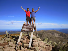
- A ranger told us of a hike to do, during our day off biking, the hike was called Scenic Point, and was the best hike I have ever done, just incredible beauty at it's summit of 7,500', tired legs too
- Saw 3 big horn sheep and mountain goats on the hike up Scenic Point
- The bike out of Two Medicine Camp to St. Mary on the East side of Glacier was very difficult, hills, wind, and heat
- Biked the Going-to-the-sun road from the east side, all the way to the avalanche, which was only a half mile from the summit of Logan Pass, at 6,600'
- Cycle north into Alberta, Canada, and camped in Cardston, and back into Montana the next day towards Cut Bank
-Decided to take a pass on Waterton Lakes Park, and start heading east
- Hit the 1,000 mile mark
- Going east, long, flat, windy, grasslands, for miles and miles
- Welcome to Cut Bank, Montana

Part 3 Cut Bank, Montana to Minot, North Dakota coming soon
-