The Adventure Cycling Association Northern Tier Bicycle Route is a cross country route that roughly follows the northern border of the "lower 48" of the United States. The route is a total of 4295 miles (6915 km). The route is divided into three route segments as follows: Anacortes, Washington, to Fargo, North Dakota, Fargo, North Dakota, to Muscatine, Iowa, and Muscatine, Iowa, to Bar Harbor, Maine
Anacortes, Washington, to Fargo, North Dakota
This section, beginning at sea level, offers large expanses of mountains, the Great Plains, and some beautiful farmland areas in between. It can be ridden from late spring to late fall. Due to snow, State Highway 20 east of North Cascades National Park in Washington is only open through certain dates. The same is true for Going-to-the-Sun Road in Glacier National Park in Montana, which is usually closed until early June. Even in the height of summer in July, cyclists must be prepared for cold nights and occasional snow in the higher elevations during storms. Due to changing local conditions, it is difficult to predict any major wind patterns.
This portion of the Northern Tier begins in Anacortes, Washington, which is located on a peninsula in Puget Sound. Anacortes is also the jumping-off point for folks going to the San Juan Islands, a favorite cycling destination. At the start, the culmination of lush forest and ocean feeds and moistens the soul. Heading eastward along the rushing Skagit River, riders carry that feeling up to the top of Rainy and Washington passes in the Cascade Mountains. Descending to the east side of the Cascades, the route enters the drier part of the state and the widely known orchard country of the Okanogan Valley. Leaving this valley, riders climb and descend several more passes full of ponderosa pines and find many sleepy farming communities down along the rivers crossed. The river valleys tend to run in a north-south direction across the northwestern part of the United States, and because the route travels west to east, riders will be working their way up and down. There are plenty of towns, rivers, lakes, mountains, and forests in eastern Washington, Idaho, and western Montana until the route reaches Cut Bank, Montana, on the eastern slope of the Rocky Mountains.
The spectacular Going-to-the-Sun Road in Glacier National Park is a hard climb but well worth it for the scenery. The route takes a jump into Canada to access Waterton Lakes National Park, and then heads back into the USA at Del Bonita, a little-used border crossing. Cut Bank is the beginning of the Great Plains, and from here on riders start praying for tailwinds. Supposedly, heading eastward, tailwinds predominate in the summer. The route uses U.S. Highway 2, the main road through central and eastern Montana along the railroad, so camping spots can occasionally be somewhat loud. Wherever possible, side roads are used to relieve the monotony of being on the highway. Afternoon thundershowers are a constant companion out on the Plains. The route follows the Missouri River from Havre, Montana, to New Town, North Dakota, and the plains of Montana eventually transform into the green rolling hills of western North Dakota. Sunflowers are everywhere, and they become the crop of choice as the terrain flattens out in eastern North Dakota. Fargo is located on the banks of the Red River, on the border of North Dakota and Minnesota.
Fargo, North Dakota, to Muscatine, Iowa
Minnesota, Wisconsin, and Iowa stand out as some of the greenest and most verdant of all the states along the Northern Tier Route. From either direction, this greenery proves to be a relief from the giant plains to the west and acres of farmland to the east. Riders learn a lot about the history of the Mississippi River as they follow its course.
This portion of the Northern Tier Route can be ridden from late spring to late fall. Due to changing local conditions, it is difficult to predict any major wind patterns, but tornadoes are common in Iowa. They mostly occur in May and June.
Heading east from Fargo and Moorhead in the Red River Valley, riders begin to slowly leave the Great Plains. Lakes and hills become the standard scenery, and the resident mosquitoes increase in number. The birthplace of the Mississippi River is in Lake Itasca State Park, in northern Minnesota. This area is so full of forests, lakes, and rivers that it draws many tourists during the summer months. The route follows the Mississippi River, until it heads east around the cities of Minneapolis, St. Paul, and surrounding suburbs. There is a spur into Minneapolis-St. Paul that ends at the airport. Along the St. Croix and Mississippi rivers, the towns are older and the buildings much more historic. At Prescott, Wisconsin, the St. Croix joins the Mississippi, and the route again follows that river southward for 175 miles. The route leaves the river occasionally on less-traveled roads, but these also mean climbing and descending the bluffs along the river. Upon entering Iowa, those not familiar with the state may think that the terrain is going to flatten out, but the hills continue after leaving the river. Small laid-back farm towns are abundant through Iowa. This section of the route ends in Muscatine, an old industrial town located on the Mississippi.
The Iowa to Maine section stretches from the Mississippi River to the Atlantic Ocean. In between it touches two of the Great Lakes, and Niagara Falls, one of the scenic wonders of North America, and then follows a transportation corridor that opened the country west of the original colonies. It passes through cities that were once the backbone of American industrialism and are now remaking themselves into the modern idiom, through hamlets, villages, and towns that define the region with a story to tell, and through places that played pivotal roles in the history of the United States.
This portion of the Northern Tier can be ridden from early spring to late fall. Due to changing local conditions, it is difficult to predict any major wind patterns. The Midwest and Great Lakes summers can be hot, especially inland. Along the Great Lakes, breezes provide cooling and are sometimes a friend and sometimes a foe.
Beginning at the Mississippi River, the route traverses the large prairie farms of central Illinois and the smaller farms of Indiana and Ohio, eventually reaching the shore of Lake Erie at Huron, Ohio. Also available is a ferry trip to one or more of the Lake Erie islands and visit the area where Commodore Oliver Perry defeated the British fleet in the War of 1812. Heading through busy Cleveland, Ohio, you'll pass the Rock and Roll Hall of Fame, the Science Center and its IMAX theater, a retired Great Lakes iron ore freighter, and a World War II submarine.
Along the lake shore in eastern Ohio and Pennsylvania, the route passes through small towns, where tourists flock to the shore during summer. In Erie, Pennsylvania, there are miles of sand beach at Presque Isle State Park, along with the replica of the sailing ship Niagara, Commodore Perry's flagship in the War of 1812 Battle of Lake Erie. Leaving Erie, the route enters the fruit and wine region of Pennsylvania and New York and hugs the relatively rural lake shore to the outskirts of Buffalo, New York. Views across Lake Erie of the Buffalo skyline and Canada usher the cyclist into the bustle of the southern end of the metropolis. A short side trip will takes riders to the Pedaling History Bicycle Museum in Orchard Park. The route passes the magnificent Basilica of Our Lady of Victory in Lackawanna, and seeing its magnificent Italian Renaissance and French Baroque architecture is a must. From Lackawanna to the Peace Bridge, the route passes through a depressed post-industrial area to emerge at the lakefront Buffalo Naval and Military Park with World War II vessels open for visits.
The route uses the Peace Bridge into Canada and follows one of the most scenic recreational trails in North America along the Niagara River to Niagara Falls. Visitors may take the cable car ride across the Whirlpool Rapids and visit the other attractions along the trail. The route then crosses back into the U.S., enjoying the view of the Niagara Gorge. Heading east, the route uses the Erie Canalway Trail for 90 miles along a waterway dripping with history. Riders can take the time to explore the towns along the Erie Canal. At Palmyra, New York, the route turns north to Lake Ontario, where it follows the lake shore to Sodus Bay, dips inland to Fair Haven, and then leaves the Great Lakes to cross the Adirondack Mountains and arrive at Ticonderoga on Lake Champlain. A visit to Fort Ticonderoga will give meaning to Revolutionary War history.
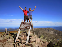
After a short ferry ride over the lake, riders are in New England, cycling through Vermont farmland, forested hills, and picturesque villages. In New Hampshire, the route follows the Connecticut River, passing through the villages of Orford with its ridge houses and Haverhill, a classic New England village with its fenced village commons and old homes. The route crosses the White Mountains, the backbone of New Hampshire, on the famous Kancamagus Highway. Mt. Washington, noted for its fierce weather, is just a few miles north, and the Kancamagus shares some of its weather reputation. Riders must be prepared, even in summer. Entering Maine, the route traverses forests and fields, arriving at Damariscotta on the Atlantic coast. Riders should allow time to savor the quintessential ambiance of the coastal towns. Before crossing the Penobscot River, riders can stray off route to visit Ft. Knox, an exceptionally well-preserved unused Revolutionary War fort. A fitting end to the trip includes cycling the gravel carriage paths of Acadia National Park and viewing a sunrise from atop Cadillac Mountain. The park is near the town of Bar Harbor, at the end of the route.
States and Provinces on the Northern Tier Bicycle Route
Washington
Idaho
Montana
Alberta, Canada
North Dakota
Minnesota
Wisconsin
Iowa
Illinois
Indiana
Ohio
Pennsylvania
New York
Vermont
New Hampshire
Maine
Thursday, March 20, 2008
Northern Tier Route Summary
Anacortes, WA, to Bar Harbor, ME (4,295 mi.)
1. Anacortes, WA, to Sandpoint, ID (462 mi.)
2. Sandpoint, ID, to Cut Bank, MT (452 mi.)
3. Cut Bank, MT, to Minot, ND (591.5 mi.)
4. Minot, ND, to Fargo, ND (316.5 mi.)
5. Fargo, ND, to Grand Rapids, MN (231.5 mi.)
6. Grand Rapids, MN, to Stillwater, MN (237 mi.)
7. Stillwater, MN, to Muscatine, IA (396.5 mi.)
8. Muscatine, IA, to Monroeville, IN (402 mi.)
9. Monroeville, IN, to Lackawanna, NY (401.5 mi.)
10. Lackawanna, NY, to Ticonderoga, NY (412.5 mi.)
11. Ticonderoga, NY, to Bar Harbor, ME (404.5 mi.)
Sunday, March 16, 2008
Countdown
With less than three months till takeoff, we are getting very excited about our adventure. The plan is for Bonnie and me to fly from Boston to Seattle on May 27th, 2008. Bonnie's sister Rosemary (who lives in Washington State) will help us get our bikes to the starting point of our trip at Anacortes, Washington. Before cycling east, we hope to spend several days in the San Juan Islands getting acquainted with our loaded touring bikes, and gearing up for the massive mountains of the North Cascades. The route that we are taking across the country is called "The Northern Tier". The Northern Tier crosses three mountain ranges: the Cascades, Rockies, and Adirondacks. Along the way, our route passes through the San Juan Islands, North Cascades National Park, Glacier National Park, Canada's Waterton Lakes National Park, the Great Plains of the midwest, the headwaters of the Mississippi, Amish country, Lake Erie, Niagara Falls, Lake Champlain and Lake George, the White Mountains of New Hampshire, Acadia National Park, and finally ends when we dip our wheels in the icy blue waters of Bar Harbor, Maine. In total, the Northern Tier Route is 4,321 miles long, crosses through 16 states, 2 countries, and 4 National Parks. "Good Luck" - We'll need it!
Subscribe to:
Posts (Atom)